MOTOR BRIDGE UK / MOTORING SOLUTIONS
Road Navigation – Smarter Routes, Smoother Journeys
Make every journey easier with Motor Bridge. Explore road navigation solutions, route planning tools and useful travel information to help you find suitable routes, avoid unnecessary delays and travel with greater confidence. Whether you're commuting, travelling for leisure or planning a longer journey, discover smarter ways to get from A to B.
Explore Road Navigation & Route Planning Providers

TomTom
Discover smarter navigation with TomTom. Explore sat nav devices and navigation apps offering route planning, live traffic updates, detailed maps and helpful road alerts to make everyday driving and longer journeys easier.
Ad · We may earn a commission.

Garmin
Explore Garmin's range of GPS sat navs and navigation technology. Discover detailed maps, turn-by-turn directions, traffic updates and helpful driver alerts on compatible devices, making everyday journeys and longer trips easier to navigate.
Ad · We may earn a commission.

Harper Collins
Explore road maps, atlases and travel guides from HarperCollins, including Collins and A–Z publications. Discover detailed UK road mapping and practical route-planning resources to help you navigate journeys with confidence.
Ad · We may earn a commission.
Navigate Smarter, Travel Further
Your interactive guide to smarter road navigation
From avoiding unnecessary delays to choosing the right navigation equipment, discover practical ways to make your journeys easier. Explore the sections below for useful navigation advice, driving tips and route-planning information.
Sat Nav or Smartphone Navigation?
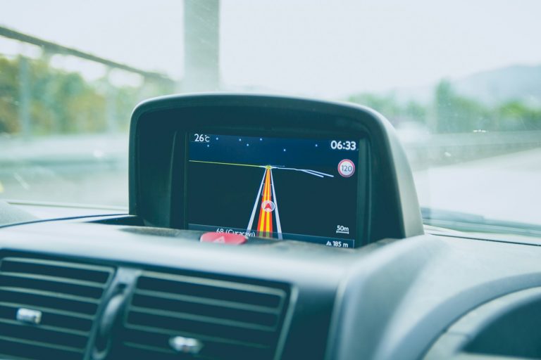
Both dedicated satellite navigation devices and smartphone navigation apps can help you plan routes, follow directions and locate destinations. The best option depends on how you travel.
Designed primarily for navigation, dedicated sat navs may offer larger displays, offline maps, lane guidance and vehicle-specific routing on compatible models.
Smartphone Navigation AppsConvenient for everyday journeys, many apps provide traffic-aware routing, destination searches and estimated arrival times. Features and connectivity requirements vary.
Motor Bridge tip: Consider screen visibility, map updates, data connectivity, mounting position and vehicle compatibility before choosing a navigation solution.
Can Live Traffic Navigation Save Time?
Traffic-aware navigation systems use available traffic information to estimate journey times and suggest alternative routes when delays are detected.
✓ Identifying reported congestion.
✓ Highlighting some road closures and incidents.
✓ Estimating journey arrival times.
✓ Suggesting alternative routes where available.
Worth knowing: Live traffic information is not always complete or immediate. A suggested diversion may not be quicker or suitable for your vehicle.
Always follow road signs, restrictions and instructions from authorised traffic personnel.
Choosing the Best Route for Your Journey
The shortest route isn't always the most suitable. Different routes may involve motorways, smaller roads, tolls, restrictions or challenging driving conditions.
Aims to minimise estimated journey time, although actual travel conditions may change.
Shortest RoutePrioritises distance rather than journey duration. This may involve slower or less suitable roads.
Avoid Motorways or TollsSome navigation systems offer preferences to avoid certain road types or charges.
Alternative RoutesUseful when considering traffic, vehicle restrictions, weather or personal driving preferences.
Smart planning: Compare distance, estimated time, road suitability and potential charges before selecting your route.
HGV, Van & Larger Vehicle Navigation
Not every road suitable for a car is appropriate for larger vehicles. Height, width, weight and access restrictions can make route planning particularly important.
✓ Vehicle height and width settings.
✓ Weight and axle-related restrictions.
✓ Potentially unsuitable road warnings.
✓ Suitable stopping and parking information.
Some specialist navigation systems support vehicle-specific routing, but coverage and accuracy vary.
Important: Never rely on navigation software alone to determine whether a route is legally permitted or physically suitable. Verify vehicle dimensions, restrictions, bridge clearances and road signs independently.
Why Keep a Road Atlas or Offline Map?
Digital navigation is convenient, but a traditional road atlas or downloaded offline map can provide an alternative when mobile coverage is limited or devices are unavailable.
✓ View larger geographical areas.
✓ Compare possible routes before travelling.
✓ Navigate without mobile data or battery power.
✓ Identify major road connections and destinations.
Did you know? Printed maps can become outdated, while offline digital maps may lack current traffic or closure information. Check publication dates and download map updates before travelling.
Motor Bridge's navigation partners include providers of sat nav technology, maps and road atlases.
Planning Stops & Longer Journeys
Good route planning involves more than choosing roads. Consider the availability of fuel, EV charging, food, toilets, parking and suitable rest locations.
✓ Check traffic and weather conditions.
✓ Plan suitable rest breaks.
✓ Consider fuel or EV charging requirements.
✓ Identify alternative stopping locations.
✓ Allow extra time for unexpected delays.
Motor Bridge tip: Our Smart Journey Resting Place Planner can help you explore potential stopping locations along your route, including motorway services and other available facilities.
Always check that the stop is suitable for your vehicle and confirm access, facilities and availability before relying on it.
Using Navigation Systems Safely & Legally
Navigation technology should assist your driving, not distract you from the road.
You must remain in proper control of your vehicle.
It is illegal to hold and use a mobile phone or other covered interactive communication device while driving, subject to limited legal exceptions.
The restriction also applies when stationary in traffic.
Hands-free navigation is permitted, but you must not become distracted or obstruct your view of the road.
Best practice: Programme your navigation before setting off. If you need to make adjustments that could distract you, stop somewhere safe and legal first.
See The Highway Code – Rules 149 and 150 for further information.
Before your next journey, ask yourself:
1. Is my chosen route suitable for my vehicle?
2. Have I checked traffic and weather conditions?
3. Do I know where I can stop safely?
4. Do I have a backup if navigation fails?
5. Is my sat nav positioned safely?
If you've considered all five, you're better prepared for the road ahead.
This guide provides general information for UK motorists. Navigation features, mapping accuracy, road restrictions, traffic information and available routes may vary by device, provider and location. Always follow current road signs, traffic regulations and official instructions. Drivers remain responsible for ensuring their chosen route is safe, legal and suitable for their vehicle. Motor Bridge may receive commission through some partner links, subject to the relevant affiliate arrangements.
Road Navigation – Frequently Asked Questions
Is a dedicated sat nav better than smartphone navigation?
Both have advantages. Dedicated sat navs may offer larger displays, offline maps and specialist vehicle routing, depending on the model. Smartphone apps are convenient and can provide traffic-aware navigation, destination searches and map updates. The best choice depends on your vehicle, journey requirements, preferred features and budget.
Can satellite navigation help me avoid traffic congestion?
Many navigation systems use traffic information to identify reported congestion, incidents and road closures. They may suggest alternative routes to help reduce delays. However, traffic conditions change and information may be incomplete or delayed. An alternative route is not guaranteed to be faster or suitable for your vehicle.
Is it legal to use a sat nav while driving in the UK?
Yes, using a properly positioned hands-free or built-in navigation system is generally permitted, provided you remain in proper control of your vehicle and are not distracted. It is illegal to hold and use a mobile phone or other covered interactive communication device while driving, subject to limited exceptions. This includes when stationary in traffic. Programme your route before travelling and stop somewhere safe and legal if adjustments could distract you.
Can I use Google Maps or another navigation app without internet access?
Some navigation apps support downloaded offline maps, allowing certain navigation functions without a mobile data connection. However, offline features vary between apps and may not include live traffic, current road closures or all route options. Download the required maps before setting off and check their coverage and expiry or update requirements.
Do I need a specialist sat nav for an HGV, motorhome or large van?
A vehicle-specific navigation system can be particularly useful for larger vehicles. Compatible products may allow you to enter vehicle height, width, length and weight to help identify potentially unsuitable routes. However, these systems cannot guarantee that every restriction will be identified. Drivers must independently check road signs, bridge clearances, vehicle restrictions and route suitability.
What should I do if my sat nav directs me towards a restricted road?
Always follow applicable road signs and legal restrictions rather than navigation instructions. If a suggested route appears unsuitable, do not proceed into a restricted or unsafe area. Find a safe and legal place to stop, review the route and identify a suitable alternative. Never make an unsafe manoeuvre or ignore restrictions because a navigation system suggests doing so.
How accurate are sat nav arrival times?
Estimated arrival times are predictions based on factors such as route distance, expected speeds and available traffic information. Actual journey times can change because of congestion, roadworks, weather, incidents and rest stops. Treat arrival times as estimates rather than guaranteed journey durations.
Are traditional road maps and atlases still useful?
Yes. Printed road maps and atlases can help with planning longer journeys, understanding wider road networks and comparing alternative routes. They can also provide a useful backup when electronic navigation is unavailable. However, printed maps may become outdated and should not be relied upon for current restrictions, closures or traffic conditions.
Can navigation systems help me avoid toll roads or motorways?
Many navigation devices and apps offer route preferences that may include avoiding motorways, toll roads or certain road types. Availability depends on the product and map coverage. Alternative routes may be longer, slower or unsuitable for some vehicles. Always check the proposed route and applicable charges before travelling.
How often should I update my sat nav maps?
Check for map and software updates regularly, particularly before long journeys. Updates may include changes to road layouts, new roads, points of interest and certain restrictions. Update frequency, charges and support periods vary between manufacturers and products. Even updated maps may not reflect every recent road change.
How can I plan suitable stops during a long journey?
Consider journey duration, driver fatigue, fuel or charging needs, parking and available facilities. Motor Bridge's Smart Journey Resting Place Planner can help identify potential stopping locations, including motorway services and other roadside facilities. Always confirm that a location is accessible, open and suitable for your vehicle before relying on it.
What should I consider before buying a sat nav or navigation product?
Consider your vehicle type, screen size, map coverage, update policy, traffic features, mounting requirements and overall cost. Some products require subscriptions or additional connectivity for certain features. Compare product specifications, compatibility, warranty information and the retailer's terms before purchasing.
These FAQs provide general road navigation information for UK motorists. Navigation features, traffic data, route suitability and map accuracy vary by provider, device and location. Drivers are responsible for following road signs, traffic laws and official instructions, regardless of navigation guidance.
Motor Bridge does not guarantee the accuracy, safety, legality or availability of routes suggested by third-party navigation products. Always check current restrictions and ensure your chosen route is appropriate for your vehicle.
Some partner links may be affiliate links. Motor Bridge may receive a commission on qualifying purchases. Product availability, pricing and features are determined by the relevant retailer or provider.
Read the Highway Code – Navigation & Driver DistractionImportant Information
The information provided by Motor Bridge UK is intended for general guidance and to help UK motorists explore available options. It does not replace professional advice, official guidance or independent research.
Products and services featured may be provided by independent third parties. Prices, availability, suitability and terms may vary, so please check all relevant details directly with the provider before making a decision.
Affiliate Disclosure: Some links may be affiliate links, meaning Motor Bridge UK may earn a commission from qualifying purchases or enquiries, at no additional cost to you. This helps support our free motoring information and tools.
Motoring Solutions
Everything you need for a smoother, safer and more enjoyable journey.